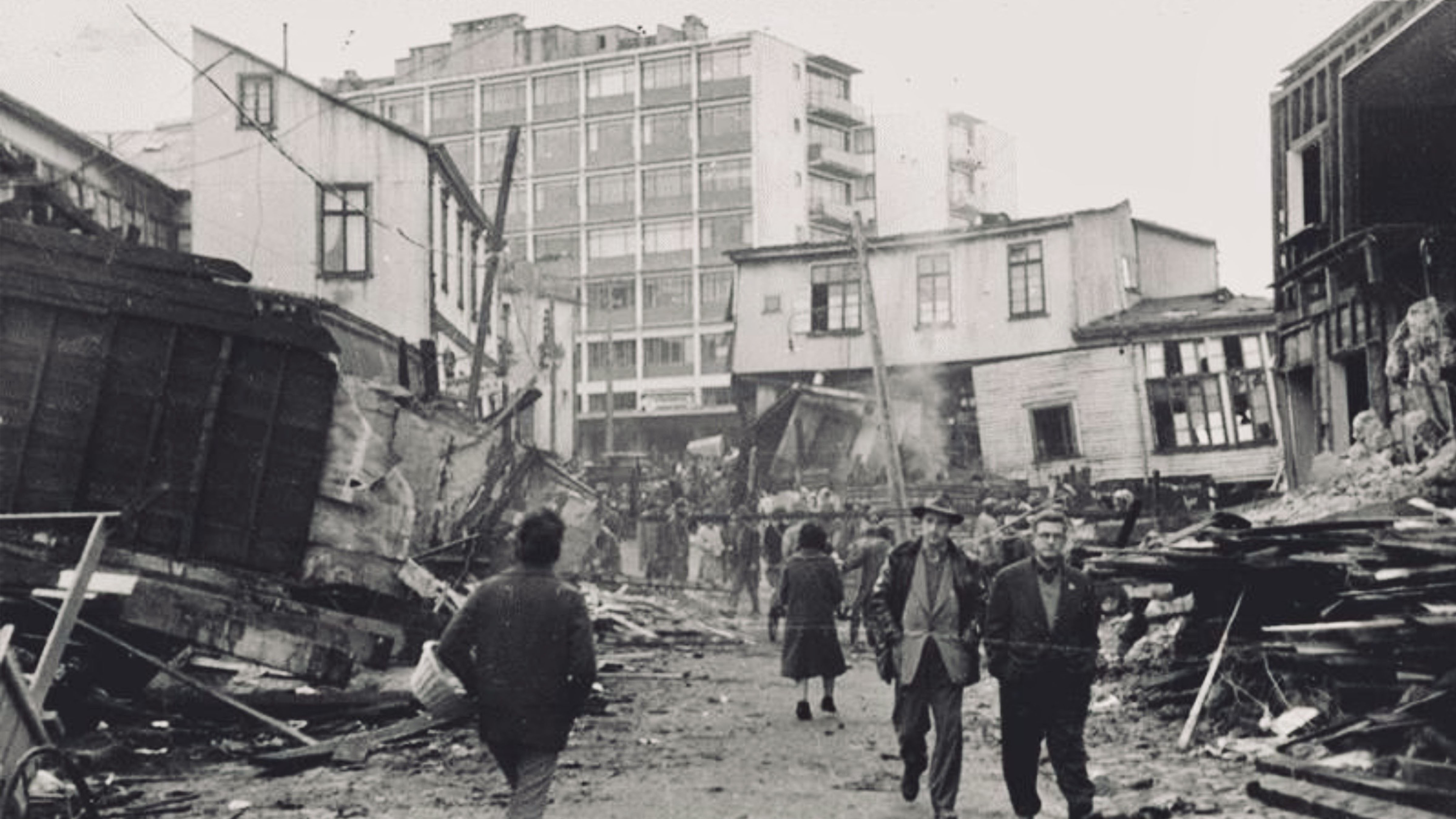
The Great Chilean Earthquake triggered devastating tsunamis across the Pacific and remains the most powerful earthquake ever recorded, permanently reshaping modern disaster science and global emergency preparedness.
On May 22, 1960, southern Chile was rocked by the most powerful earthquake ever instrumentally recorded, a catastrophic magnitude 9.5 megathrust quake that devastated entire cities, triggered deadly tsunamis across the Pacific Ocean, and altered the scientific understanding of Earth’s tectonic forces.
More than six decades later, the Great Chilean Earthquake, also known as the Valdivia earthquake, continues to influence modern earthquake engineering, tsunami warning systems, emergency planning, and global geological research. The disaster demonstrated the immense destructive power of subduction-zone earthquakes and exposed the vulnerability of coastal populations around the Pacific Ring of Fire.
The earthquake struck at approximately 3:11 p.m. local time near the city of Valdivia in southern Chile. Violent shaking lasted for several minutes across a massive section of the country. Entire communities collapsed as roads cracked apart, bridges failed, railways twisted, and buildings crumbled under the force of the seismic waves.
The rupture occurred along the boundary where the Nazca Plate is forced beneath the South American Plate, one of the most active tectonic regions on Earth. Scientists later estimated that the fault rupture extended for roughly 1,000 kilometres along the Chilean coastline, releasing an extraordinary amount of energy.
The earthquake did not occur in isolation. In the days leading up to May 22, Chile had already experienced several major foreshocks, including a powerful magnitude 8.1 earthquake near Concepción on May 21. Many buildings had already been weakened before the main rupture struck the following day.
Valdivia, one of the hardest-hit cities, suffered catastrophic destruction. Entire neighbourhoods were flattened, riverbanks collapsed, and widespread flooding compounded the devastation. Landslides buried roads and isolated remote communities, severely hampering rescue efforts.
The death toll remains difficult to determine precisely due to the scale of destruction and communication failures at the time. Most historical estimates place fatalities between 1,000 and 6,000 people, while millions more were displaced or affected throughout Chile.
The earthquake also triggered one of the deadliest tsunami events of the twentieth century. Massive waves radiated outward across the Pacific Ocean within hours of the quake. Coastal towns in southern Chile were obliterated as tsunami waves surged inland, sweeping away homes, boats, docks, and infrastructure.
But the disaster quickly became international.
Approximately 15 hours after the earthquake, tsunami waves reached Hawaii, where parts of Hilo were heavily damaged and dozens of people were killed. The waves later struck Japan, the Philippines, New Zealand, Australia, and portions of the western United States. In Japan alone, more than 100 people died after tsunami waves flooded coastal communities thousands of kilometres from the earthquake’s epicentre.
The global reach of the tsunami stunned scientists and governments alike. It highlighted the urgent need for international tsunami monitoring systems and faster communication networks capable of warning coastal populations before deadly waves arrived.
In the aftermath, scientific interest in plate tectonics and seismic behaviour accelerated significantly. Although plate tectonic theory was still developing during the early 1960s, the Great Chilean Earthquake provided critical evidence supporting the understanding of large-scale tectonic plate movement beneath Earth’s surface.
Researchers later determined that portions of Chile’s coastline permanently shifted during the earthquake. Some coastal areas subsided below sea level, while others were uplifted by several metres. Rivers changed course, and parts of the landscape were permanently transformed.
The disaster also triggered volcanic activity. Days after the earthquake, the Puyehue volcano erupted in southern Chile, adding further disruption to an already devastated region.
Chile’s economy suffered enormous damage. Infrastructure destruction affected transportation, agriculture, fisheries, energy systems, and housing across large sections of the country. Recovery efforts continued for years, requiring major international assistance and reconstruction planning.
Despite the devastation, the disaster ultimately helped drive major improvements in building standards and seismic engineering throughout Chile. Modern Chilean infrastructure is now considered among the most earthquake-resistant in the world, shaped directly by lessons learned from the 1960 catastrophe and later seismic events.
Globally, the earthquake transformed tsunami preparedness. The Pacific Tsunami Warning Center, established shortly before the disaster, became increasingly important after the event exposed how rapidly tsunami threats could cross entire oceans. International monitoring systems have since expanded significantly, using seismic sensors, ocean buoys, satellites, and real-time communication networks to improve warning times.
Today, the 1960 Valdivia earthquake remains a benchmark event in geology and disaster science. It is still studied extensively by seismologists, engineers, emergency planners, and climate resilience researchers seeking to better understand extreme natural disasters and reduce future loss of life.
The disaster also serves as a reminder of the immense forces operating beneath Earth’s surface. While technology and forecasting systems have improved dramatically since 1960, scientists continue to emphasize that major earthquakes remain impossible to predict precisely.
Along much of the Pacific Ring of Fire, including Chile, Japan, Indonesia, Alaska, and the western coast of North America, millions of people still live in regions vulnerable to similar megathrust earthquakes and tsunamis.
More than sixty years later, the Great Chilean Earthquake continues to shape global disaster preparedness, scientific research, and international awareness of seismic risk. It remains not only the strongest earthquake ever recorded, but one of the most consequential natural disasters in modern history.
About the Author Brad Socha is the founder of The Universal Record, focused on sourced, factual global reporting. Coverage includes international news, geopolitics, technology, and major developments.