The eruption of Mount St. Helens on May 18, 1980, remains one of the most devastating natural disasters in modern United States history. More than four decades later, scientists continue studying the eruption because of its enormous environmental impact, its role in advancing volcanic monitoring systems, and its lasting influence on disaster preparedness around the world.
The eruption occurred in southwestern Washington State after weeks of earthquakes, steam explosions, and growing pressure beneath the volcano. At 8:32 a.m. local time, a massive earthquake triggered the collapse of the volcano’s north flank, unleashing an enormous lateral blast that flattened forests, destroyed infrastructure, and sent volcanic ash thousands of feet into the atmosphere.
The eruption killed 57 people and caused widespread destruction across hundreds of square miles. Entire forests were levelled within minutes, rivers became clogged with volcanic debris, highways were destroyed, and ash clouds spread across multiple U.S. states. The event dramatically altered the surrounding landscape and became one of the most extensively studied volcanic eruptions in recorded history.
The scale of the eruption surprised many scientists at the time because Mount St. Helens had previously been considered one of the less dangerous volcanoes in the Cascade Range. The mountain had shown warning signs during the spring of 1980, including seismic activity and visible bulging on the volcano’s north side, but the force and direction of the eruption exceeded many expectations.
The blast released energy comparable to hundreds of atomic bombs and removed a significant portion of the mountain’s summit. The eruption column rose more than 80,000 feet into the atmosphere, spreading ash across large sections of North America. Communities across Washington and neighbouring states experienced darkness during daylight hours as ash fell over roads, buildings, farms, and water systems.
The eruption also caused massive economic losses. Timber industries suffered major damage as millions of trees were destroyed. Transportation networks were disrupted, agricultural operations were affected by ash contamination, and cleanup efforts cost hundreds of millions of dollars. Ashfall forced airport closures and disrupted aviation across the region.
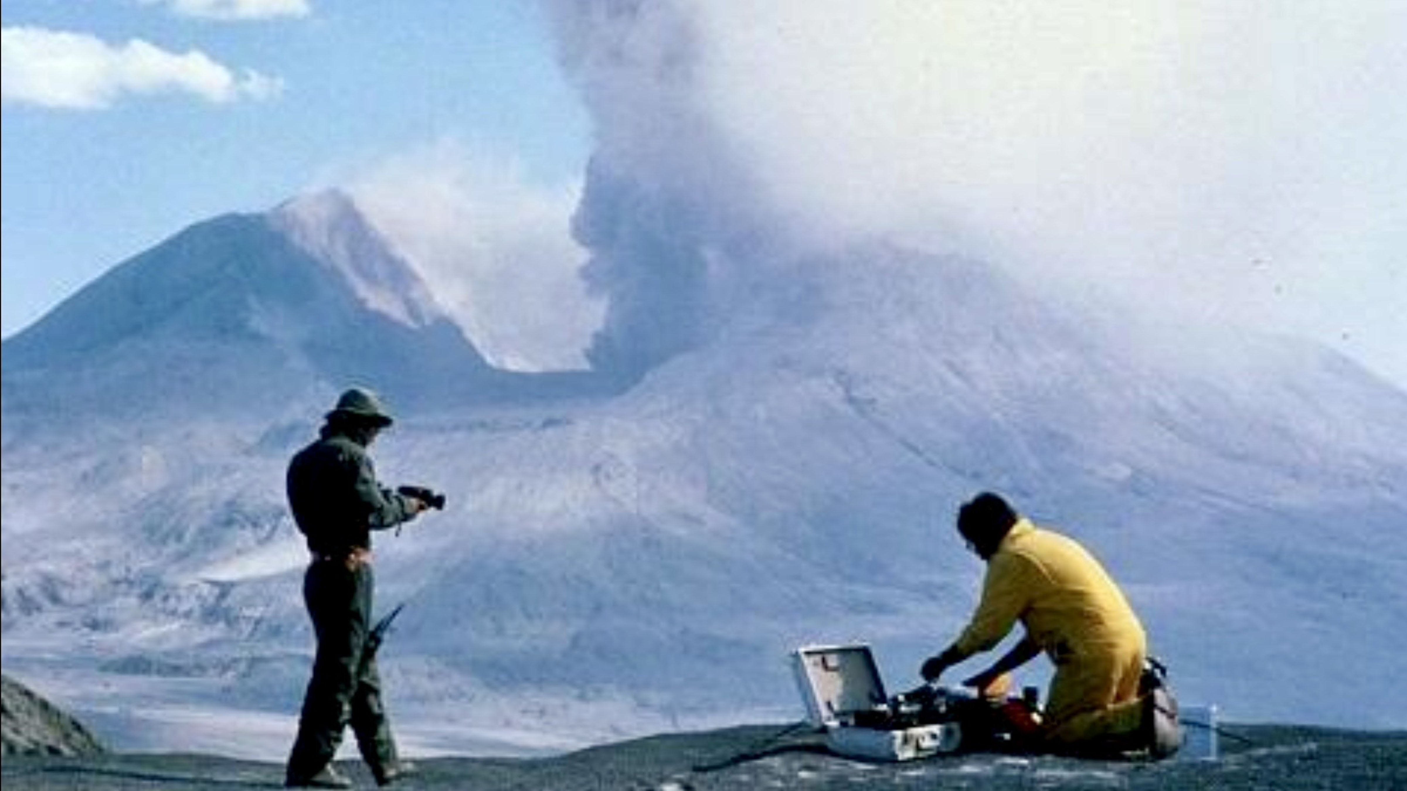
Scientists now view Mount St. Helens as a turning point in volcanic research and hazard management. Monitoring technology and emergency planning systems improved significantly after the disaster. The eruption accelerated advances in seismic monitoring, satellite observation, gas measurements, and early warning systems designed to detect volcanic activity more accurately.
Researchers continue studying the area because the eruption created a rare opportunity to observe how ecosystems recover following large-scale destruction. Forest regrowth, wildlife return, and long-term environmental changes have provided valuable scientific data about ecological resilience and natural recovery processes.
The eruption zone eventually became protected within the Mount St. Helens National Volcanic Monument, established by the U.S. government in 1982. The site remains an important location for geological research, tourism, and environmental education.
Volcanologists frequently reference Mount St. Helens when discussing volcanic risks worldwide. Lessons learned from the eruption have influenced monitoring programs near active volcanoes in countries including Japan, Indonesia, Iceland, Italy, and the Philippines. Improved hazard communication and evacuation planning are often linked to insights gained after the 1980 disaster.
The event also changed public understanding of volcanic threats in the continental United States. Before 1980, many Americans viewed volcanic eruptions as distant events associated mainly with other regions of the world. Mount St. Helens demonstrated that major volcanic disasters could occur within the United States and affect large populations, economies, and infrastructure systems.
Modern monitoring at Mount St. Helens remains active today because the volcano continues to show periods of activity. Scientists from the United States Geological Survey closely monitor seismic changes, ground deformation, and gas emissions to identify potential future risks. While the volcano has experienced additional eruptions since 1980, none have matched the scale or destructive power of the original event.
The eruption remains deeply connected to American scientific history because it fundamentally reshaped volcanic hazard research. Emergency management agencies, geologists, and climate researchers still examine the disaster when studying natural hazards and environmental resilience.
Historical footage and photographs of the eruption continue to circulate globally because of the event’s dramatic visual impact. Towering ash clouds, flattened forests, and devastated landscapes became some of the defining natural disaster images of the late 20th century.
More than 40 years later, Mount St. Helens remains both a scientific case study and a reminder of the destructive power of natural geological processes. The eruption permanently changed landscapes, communities, and scientific understanding while becoming one of the most important volcanic events ever recorded in North America.
About the Author Brad Socha is the founder of The Universal Record, focused on sourced, factual global reporting. Coverage includes international news, geopolitics, technology, and major developments.


")

Leave a Reply