Long before satellites and astronauts revealed our planet from above, a camera aboard a former wartime rocket captured a view that would change how humanity observed Earth.
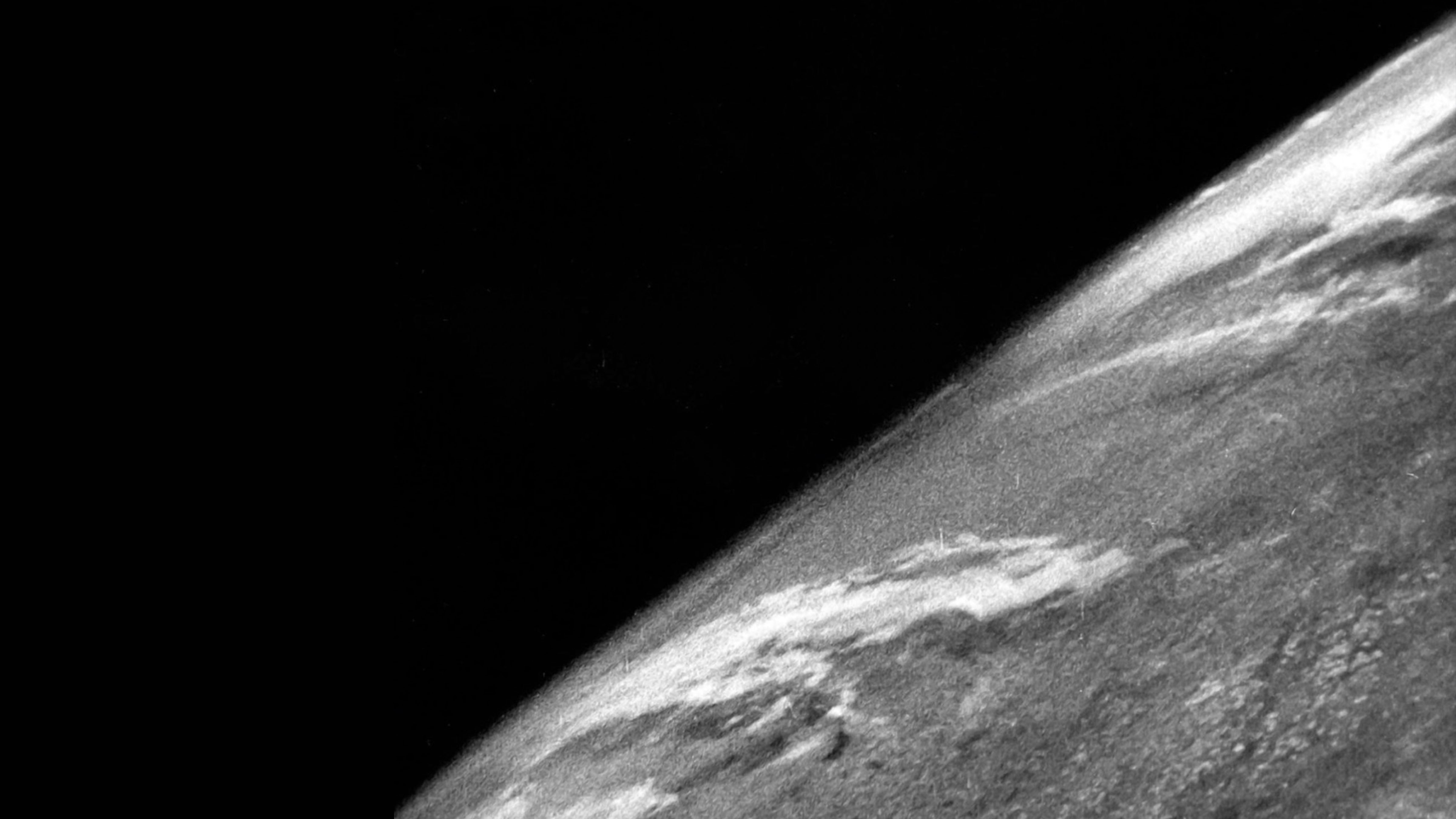
Feature image: The first photograph of Earth from space, taken October 24, 1946. Credit: White Sands Missile Range / Applied Physics Laboratory (public domain).
On October 24, 1946, a camera aboard a V-2 rocket launched from White Sands, New Mexico, captured the first known photograph of Earth from space. The grainy black-and-white image was taken approximately 105 kilometres above the surface, revealing the planet’s curved horizon from a perspective no camera had previously reached.
The photograph marked an important step toward space-based observation, arriving nearly 11 years before the Soviet Union launched Sputnik 1 and more than two decades before astronauts photographed Earth from the Moon.
Eighty years later, the achievement remains a milestone in the history of space exploration and scientific photography.
Unlike the detailed satellite images available today, the original photograph showed only a portion of Earth. Its significance came from the altitude at which it was taken and the technology that made the image possible.
From Wartime Rocket to Scientific Instrument
The photograph emerged from a research programme built around technology developed for warfare.
During the Second World War, Nazi Germany developed the V-2 ballistic missile, which was used to attack cities including London and Antwerp. Its development also relied on forced labour under brutal conditions, resulting in thousands of deaths.
Following Germany’s defeat in 1945, the United States obtained V-2 rockets, components and technical expertise as part of its postwar missile research.
The captured rockets were transported to White Sands Proving Ground in New Mexico, where American military personnel and civilian scientists began adapting them for experimental flights.
Although the V-2 had been designed as a weapon, its powerful liquid-fuel engine could carry scientific instruments to altitudes previously inaccessible to most research equipment.
Scientists used the rockets to investigate atmospheric pressure, temperature, cosmic radiation and other conditions high above Earth.
The programme also offered an opportunity to experiment with photography.
Before these flights, high-altitude balloons had provided some of the most elevated photographs of Earth’s surface. In 1935, the Explorer II balloon reached approximately 22 kilometres, allowing photographs that showed the planet’s curvature.
A V-2 could travel several times higher.
Engineer Clyde Holliday of the Johns Hopkins University Applied Physics Laboratory helped develop a camera system capable of operating during a rocket flight.
The equipment used a 35-millimetre motion-picture camera programmed to expose a frame approximately every 1.5 seconds.
This approach meant the camera could continuously record changing views as the rocket climbed, rather than relying on a single exposure at its highest altitude.
The experiment would also test whether photographic film could survive the rocket’s return to Earth.
The First Photograph From Space
On October 24, 1946, V-2 rocket No. 13 lifted off from White Sands carrying the camera.
The missile followed a suborbital trajectory, rising above the atmosphere’s densest layers without achieving the speed necessary to circle Earth.
It reached approximately 105 kilometres, or 65 miles, above the surface.
That altitude exceeded the 100-kilometre Kármán line, a widely used reference boundary for the beginning of outer space.
As the rocket climbed, the camera recorded successive frames showing increasingly broad views of the landscape below.
From its highest altitude, the images captured the curved horizon, cloud formations and the contrast between Earth’s surface and the darkness beyond.
The flight lasted only minutes.
The rocket subsequently fell back toward the New Mexico desert, striking the ground at high speed. The camera was destroyed, but its photographic film survived inside a protective steel cassette.
Recovery personnel retrieved the cassette, allowing the exposed film to be developed and examined.
The resulting photographs revealed a view of Earth that had never previously been recorded from space.
The images were not photographs of the entire planet. They showed a section of the southwestern United States and its surroundings from an extraordinary altitude.
Their scientific value extended beyond their historical distinction.
High-altitude photographs offered researchers a way to observe broad geographic areas, cloud patterns and atmospheric conditions from above.
They also demonstrated that rockets could carry cameras into space and return useful photographic information, even when the launch vehicle itself was not recovered intact.
The experiment became part of a continuing series of photographic flights.
In March 1947, another V-2 captured images from an altitude exceeding 160 kilometres, providing more extensive views of Earth’s surface.
By 1950, rocket-mounted cameras had returned more than 1,000 photographs from high above the planet.
The growing collection suggested possibilities for mapping, meteorology and other scientific applications that would later become central to satellite technology.
The next major development came on October 4, 1957, when the Soviet Union launched Sputnik 1, the world’s first artificial satellite.
Unlike the V-2 flights, which briefly entered space before returning to Earth, satellites could remain in orbit and repeatedly observe the planet.
On August 14, 1959, the American Explorer 6 satellite obtained the first photograph of Earth from orbit.
The TIROS-1 weather satellite, launched in April 1960, subsequently demonstrated how space-based images could contribute to meteorological observations.
Later missions provided increasingly detailed views of Earth, including the celebrated Earthrise photograph taken by Apollo 8 astronaut William Anders on December 24, 1968.
The progression from experimental rocket photography to orbital observation helped establish technologies now used to track storms, monitor environmental changes, study oceans and map Earth’s surface.
The photograph taken on October 24, 1946, was modest by modern standards. It was a small, grainy image produced by a camera that did not survive its flight.
Yet the recovered film demonstrated something fundamental: Earth could be photographed from beyond the atmosphere.
That achievement opened a new perspective on the planet and helped lay the groundwork for the space-based observations that have become essential to modern science.
About the Author Brad Socha is the founder of The Universal Record, focused on sourced, factual global reporting. Coverage includes international news, geopolitics, technology, and major developments.